
Crusader Map of Jerusalem, 12th century
Crusader Map of Jerusalem
Twelfth Century
Photographic reproduction
Original manuscript 31.3 x 21.0 cm
Bibliothèque Royale de Belgique, Brussels
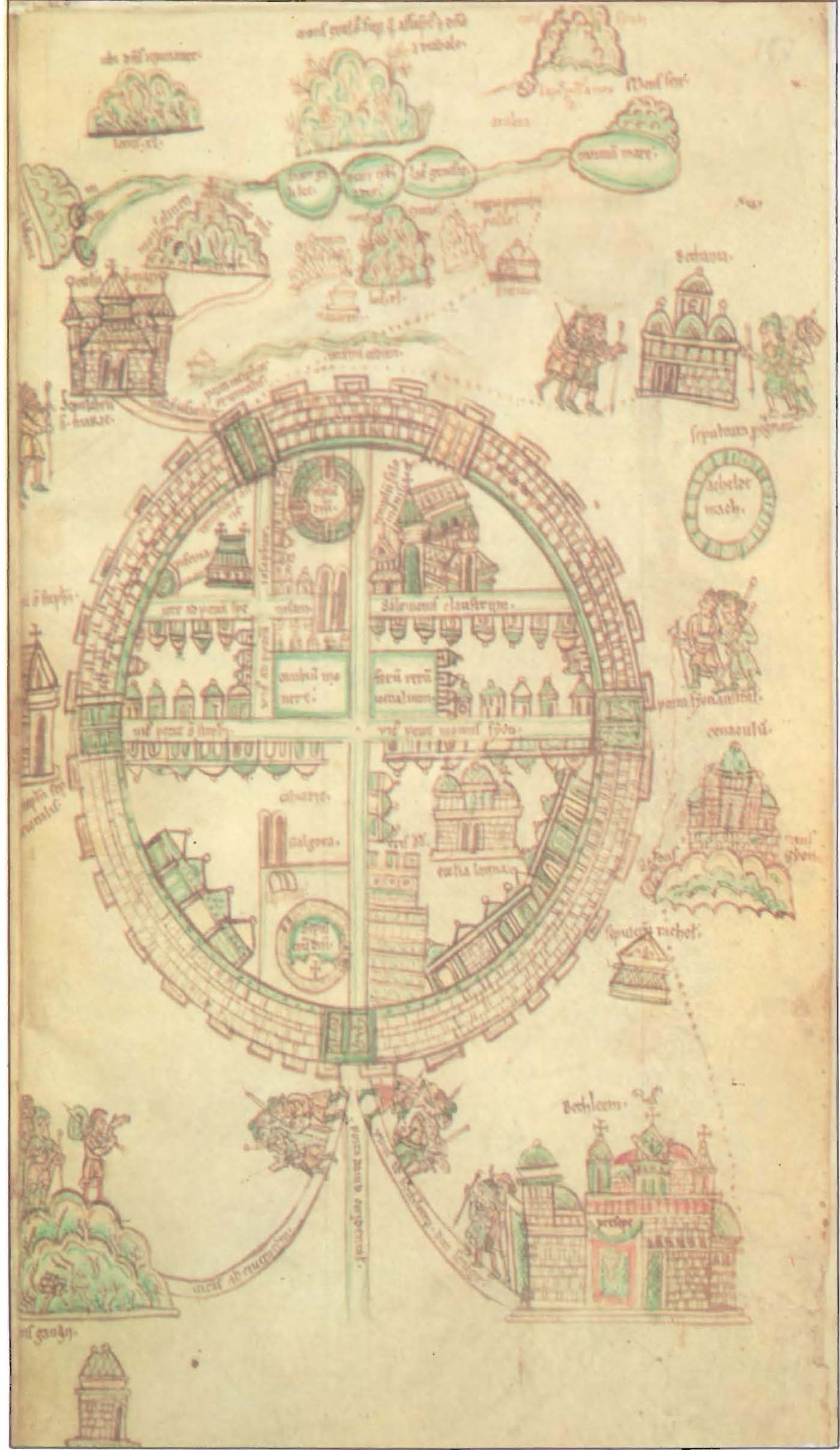
This is a reproduction of one of the first Crusader maps of the Holy Land, dating from the early twelfth century. It is pictorial in style with east at the top. A disproportionately large schematic depiction of Jerusalem is at the center, surrounded by small images of other cities and topographic features of the Holy Land, crowded into the available space without regard for relative size or scale. Jerusalem is portrayed as a circular walled city in a pattern resembling medieval maps of the world. The city is divided into quarters by two main avenues. The transverse avenue leads from St. Stephen’s Gate in the north (at left) to Zion Gate in the south (at right). The vertical avenue connects David’s Gate in the west (bottom) with the Temple Mount in the east (top). The major religious sites are portrayed in their approximate locations, with their Crusader names. Small groups of pilgrims are depicted making their way to and from various shrines.
University of Southern Maine- Maps and the History of Jerusalem
Subscribe
If you enjoyed this article, subscribe to receive more just like it.


