
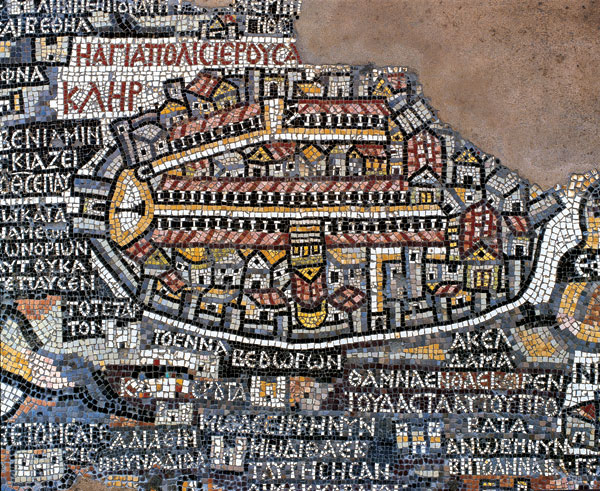
The holy land, from Lebanon to the Nile Delta, and from the Mediterranean to the Jordanian desert, is depicted on the Madaba mosaic map, found in a sixth-century Byzantine church about 18 miles south of Amman, Jordan. The map covers about 33 square yards of the church’s floor (it was probably originally three times as large) and is composed of more than two million stone and glass tesserae. Jerusalem, pictured here, lies at the center of the map and is disproportionately large—as the city was considered by Christians to be the center of the world. Also disproportionately large, the Church of the Holy Sepulchre (shown inverted) is located at the center of the city. A row of brown tesserae (near the top of the city) may represent the vacant Temple Mount—though many scholars believe the Temple Mount was simply left off the map—in accord with Jesus’ prophecy that the Jewish Temple on the Temple Mount would be obliterated (see Matthew 24-2; Mark 13-2; Luke 21-6).
Islam on the Temple Mount, Moshe Sharon, BAR 32-04, Jul-Aug 2006.
See also-