
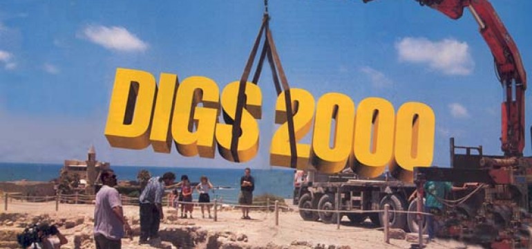
We’re proud to present the Year 2000 guide to excavations that need volunteers. Learn about the history of each site, who’s doing the work and what their plans are for the coming summer. The contact information for each site appears on the chart on pages 40–43. But if you aren’t sure you want to spend two weeks or more getting down and dirty, keep reading to find out if you can just visit for a day. Most sites have visiting hours, and some have guided tours. Even if you can’t get to the sites in person, our descriptions will give you an overview of the cutting-edge research going on right now in the lands of the Bible.
Abila
Situated about 10 miles south of Irbid in northern Jordan, Abila was one of the cities of the Decapolis, a federation of ten cities in eastern Palestine (Matthew 4-25; Mark 5-20, 7-31). Evidence of human habitation at Abila ranges from 3500 B.C. to 1450 A.D., and several ancient writers mention the site, including Polybius, Pliny the Elder and the geographer Ptolemy. Many ruins are visible on the site’s two mounds, Tell Abila in the north and Khirbet Umm el-’Amad (Ruins of the Mother of the Columns) in the south.
A cache of early church glass lamps, five churches, a life-size statue of Artemis, an aqueduct system, painted tombs and a theater were uncovered in past years. In 2000 dig director W. Harold Mare (Covenant Theological Seminary) plans to excavate the site’s theater, bathhouse and tombs. The site is open to visitors year-round; no appointment is necessary. Guided tours are available during the dig season.
BAR articles- Larry G. Herr, “Magic Carpets,” BAR 22-02; Yoram Tsafrir, “Ancient Churches in the Holy Land,” BAR 19-05.
Acre (Akko)
Acre, 13 miles north of Haifa, was an important coastal city in antiquity- Two crucial routes—the coastal highway and a road leading to the Mediterranean from Transjordan and Syria—converged there.
According to Judges 1-31, “Asher did not drive out the inhabitants of Akko [Acre], or the inhabitants of Sidon.” During David’s reign and the early part of Solomon’s, Acre probably belonged to the United Monarchy; later in Iron Age II—the eighth and seventh centuries B.C.—it was a prominent Phoenician city. Acre later became an important center of the Persian Empire, playing a strategic role in the skirmishes between Egypt and Persia. Acre has been visited by the likes of St. Francis of Assisi, Marco Polo and Paul; its harbor was the last significant base of the Crusaders in the Holy Land and the cavernous Crusader remains attract many visitors.
Significant finds east of the Old City include a monumental building, possibly the headquarters of the Teutonic knights, and public buildings and domiciles from the Crusader period. The finds are thought to have been located within the late-12th-century A.D. walls of Acre. In 2000 dig directors Adrian Boas (Haifa Univ.) and George Philipp Melloni (Deutcher Orden, Haifa [Akko] Office) hope to uncover most of the monumental building and to excavate trial trenches in adjacent areas. Visitors are welcome during the dig season only, and an appointment is necessary. No tours are available.
El-Ahwat
Located on a high hill 9 miles east of Caesarea, El-Ahwat is the site of the northwesternmost Israelite settlement in the region of Manasseh. Previous seasons at the site, which was occupied between the Late Bronze Age and the early Iron Age, revealed a large, heavily fortified Iron Age I village, with a city wall, towers and a gate. Dig director Adam Zertal (Haifa Univ.) believes the site was probably settled by the Shardana, one of the Sea Peoples. Cylinder seals, Egyptian scarabs, pottery and several bronze artifacts were discovered at the site. In 2000 Zertal plans to continue exploring the site’s fortification system.
Ashkelon
The Philistine city of Ashkelon, a major Mediterranean seaport of the Canaanites and Philistines from 3000 to 604 B.C., figures prominently in the Bible. Samson, in a rage, killed 30 men there (Judges 14-19). “Proclaim it not in the bazaars of Ashkelon,” David lamented when he learned of the deaths of Saul and Jonathan, slain by the Philistines at the Battle of Gilboa (2 Samuel 1-20). The prophet Jeremiah, in his oracle against the Philistines, pronounced that “Ashkelon has perished” and that “the sword of the Lord,” in the hands of King Nebuchadnezzar and the Babylonian army, was drawn “against Ashkelon and against the seashore” (Jeremiah 47-5–7).
Previous excavations at Ashkelon have uncovered a vast array of remains- the world’s oldest arched gateway (featured on the cover of the January/February 1993 BAR), Canaanite ramparts and monumental buildings, and the ruins of the last Philistine city, destroyed by Nebuchadnezzar in 604 B.C. Also discovered were bronze figurines and vessels from Egypt; beautiful pottery imported from Greece, Iona, Cyprus and Phoenicia; a Canaanite cult object from the second millennium B.C.; and a tiny calf fashioned from bronze and silver (featured on the cover of the March/April 1991 BAR). In the upcoming season, dig director Lawrence Stager (Harvard Univ.) plans to excavate Canaanite houses and the City of the Dead, the earliest Philistine settlements and the Persian, Hellenistic and Roman cities. Ashkelon is open daily to visitors, but an appointment is necessary. Guided tours are available.
BAR articles- Patricia Smith and Lawrence E. Stager, “DNA Analysis Sheds New Light on Oldest Profession at Ashkelon,” BAR 23-04; Frank Moore Cross, “A Philistine Ostracon from Ashkelon,” BAR 22-01; Stager, “The Fury of Babylon- Ashkelon and the Archaeology of Destruction,” BAR 22-01, “Eroticism and Infanticide at Ashkelon,” BAR 17-04, “Why Were Hundreds of Dogs Buried at Ashkelon?” BAR 17-03, “When Canaanites and Philistines Ruled Ashkelon,” BAR 17-04.
Banias (Caesarea Philippi)
Located at the foot of Mt. Hermon near the wellspring of the Jordan River, Banias (Caesarea Philippi in the Gospels) was occupied from the early Roman to the Ottoman period, and is associated with Jesus’ Galilean ministry (Matthew 16-13; Mark 8-27). Excavations have unearthed the early Roman city, with a palace and arched storerooms. Nearby, a large spring flows from the Cave of Pan, a shrine established in the third century B.C. Dig director Vassilios Tzaferis (Israel Antiquities Authority [IAA]) will expose more of the palace in 2000. The site is open to visitors all year, and no appointment is necessary.
BAR article- John F. Wilson and Vassilios Tzaferis, “Banias Dig Reveals King’s Palace,” BAR 24-04.
Beit Guvrin
An important city in southern Israel during the Roman period, Beit Guvrin was named a polis (city-state) in 200 A.D., when Emperor Septimius Severus (193–211) granted it the largest amount of land of any city in Palestine. It lay at the intersection of five major roads and covered approximately 110 acres in its heyday. Occupied from 100 B.C. to the present, the site has yielded extensive remains from the Roman, Byzantine and Crusader periods, including a Roman-Byzantine amphitheater; public baths, mosaics and tombs; and a Crusader church and fortifications. Nearby is the site of Maresha, the City of Cave Dwellers, famed for its 3,000 man-made caves, which functioned as chalk quarries, dovecotes, dwellings, storage areas and tombs. In the upcoming season, dig directors Amos Kloner (Bar-Ilan Univ. and IAA) and Michael Cohen (IAA) will work to reveal the plan of the Roman city. The site is open to visitors every day from 8 a.m. to 4 p.m., and guided tours are available by appointment.
BAR article- Amos Kloner, “Underground Metropolis—The Subterranean World of Maresha,” BAR 23-02.
Bethsaida
The Gospels mention Bethsaida more often than any other town except Jerusalem and Capernaum, but Bethsaida—meaning “House of the Fisherman”—was lost to the modern world until archaeological excavations began there in 1987. An important city in the first century A.D., Bethsaida was destroyed by the Romans during the First Jewish Revolt (66–70 A.D.) and never rebuilt. (The historian Flavius Josephus, who led the Jewish forces near here, claims the battle would have been won if he hadn’t fallen from his horse and sprained his wrist.) Rami Arav (Univ. of Nebraska at Omaha) found the Biblical city through probes and surveys; he was responsible for literally putting Bethsaida on the map—the official map of Israel—for the first time in 1989.
The birthplace of the apostles Peter, Andrew and Philip, Bethsaida was the town where Jesus restored a blind man’s sight (Mark 8-22–26) and fed the multitude (Luke 9-10–17). Located on the east side of the Jordan River, slightly north of the Sea of Galilee, Bethsaida has yielded Roman and Hellenistic houses, an unusual statue of the Egyptian god Pataekos (featured on the cover of the January/February 1995 BAR) and a strongly fortified city from Iron Age II. This coming season, dig directors Rami Arav and Richard Freund (Univ. of Hartford) plan to uncover more of the Iron Age gate and to excavate residential quarters from the first century A.D. The site is open to the public seven days a week; appointments are necessary for guided tours.
BAR articles- See “Bethsaida Rediscovered,” in this issue, and Rami Arav and Richard A. Freund, “The Bull from the Sea- Geshur’s Chief Diety?” BAR 24-01, and “An Incense Shovel from Bethsaida,” BAR 23-01; Arav, “An Iron Age Amulet from the Galilee,” BAR 21-01.
Beth-Shemesh
A frontier city on the western border of Judah, Beth-Shemesh was an arena of battle between the Philistines and the Judahites; it was also where the Philistines returned the Ark of the Covenant to the Israelites (1 Samuel 6). The city later served as an important administrative center in Solomon’s kingdom (1 Kings 4-9). It was destroyed by the Assyrians in 701 B.C.
Beth-Shemesh, located in the lowlands 15 miles southwest of Jerusalem, has yielded finds dating to the early Israelite monarchies, including an Israelite village, massive fortification systems, a huge cross-shaped underground rock-cut reservoir, a storage facility and olive-oil extraction facilities. Although the Bible identifies Beth-Shemesh as Israelite during the period of the Judges (Joshua 19-41), excavators have uncovered a curious array of Canaanite, Israelite and Philistine artifacts that suggest considerable political and cultural interaction. Dig directors Zvi Lederman and Shlomo Bunimovitz (both of Tel Aviv Univ.) hope to uncover more of the Iron Age (Israelite) village, the destruction level of the Canaanite city and parts of the city’s fortification system. Volunteers will continue excavating a royal storage facility packed with broken pottery vessels.
BAR article- Shlomo Bunimovitz and Zvi Lederman, “Beth-Shemesh- Culture Conflict on Judah’s Frontier,” BAR 23-01.
Caesarea Maritima
One of the most majestic of ancient Israel’s sites, Caesarea Maritima covers a vast area of 235 acres on the Mediterranean coast between Tel Aviv and Haifa. Occupied from the third or fourth century B.C. through the Crusader period, Caesarea first became a city under Roman rule, but it reached its apogee during the Byzantine period. The apostle Peter first converted gentiles to Christianity here (Acts 10), and the apostle Paul was imprisoned here (Acts 23–26). According to Josephus, Herod built the city between 22 and 10 B.C., on the site of an earlier Phoenician and Hellenistic trading station known as Strato’s Tower, and named it in honor of his patron, Caesar Augustus. The city became a major port, thanks to the large artificial harbor Herod built there—the only all-weather port on his kingdom’s coast. The harbor could hold the entire Roman fleet and was noted in antiquity as an engineering marvel. Caesarea continued to serve as a port for a thousand years.
Marine excavators have uncovered Herod’s harbor and later harbors built on top of it. On land their colleagues have excavated myriad structures—including the ancient city’s street plan; a well-preserved aqueduct system; a theater; a circus; a waterfront warehouse complex; several baths, shops and dwellings; and the remains of an early synagogue, as well as a Christian church built over the ruins of King Herod’s temple to Roma and Augustus. Splendid Crusader fortifications have also been uncovered. Since the 1950s the site has yielded a vast assortment of statuary, inscriptions—including one bearing the name of the Roman governor Pontius Pilate—coins, mosaics, ceramics and other finds. This season dig directors Kenneth G. Holum (Univ. of Maryland, College Park) and Avner Raban (Univ. of Haifa) will continue to explore the harbor’s underwater architectural remains, the Herodian temple to Roma and Augustus, and a warehouse and dwelling quarter north of the inner harbor. Caesarea Maritima is open to visitors year-round from 8 a.m. to 5-30 p.m. No appointment is necessary.
BAR articles- “Caesarea Maritima Yields More Treasures,” BAR 20-01; Barbara Burrell, Kathryn Gleason and Ehud Netzer, “Uncovering Herod’s Seaside Palace,” BAR 19-03; Kenneth G. Holum, “From the Director’s Chair- Starting a New Dig,” BAR 17-01; Lindley Vann, “Herod’s Harbor Construction Recovered Underwater,” BAR 09-03; Robert L. Hohlfelder, “Caesarea Beneath the Sea,” and Robert J. Bull, “Caesarea Maritima—The Search for Herod’s City,” BAR 08-03.
Dor
Tel Dor, which lies on the Mediterranean coast about 15 miles south of Haifa, has seen mighty shifts in its political fortunes over the years. One of the Canaanite cities defeated by Joshua (Joshua 12-23), Dor was founded by the Canaanites in about 1900 B.C. and fell to the Sikils—a Sea People tribe—in 1200 B.C. The Phoenicians (Canaanites pushed north by the Sea Peoples) reconquered the city in 1050 B.C. and dominated its culture for the next 800 years. Politically, however, Dor came under Israelite control, becoming the capital of one of Solomon’s administrative districts, ruled by Solomon’s son-in-law (1 Kings 4-11), and playing an important role in ancient Israel’s economy. The Assyrian king Tiglath-pileser III (744–727 B.C.) conquered Dor in 732 B.C. and made it an Assyrian administrative center. In the Hellenistic period, Dor was a major fortress. The city continued to thrive in the Roman period, and its last occupation is marked by the ruins of a Crusader fortress from the 13th century.
Past excavations have revealed gates and fortifications from the Hellenistic, Persian and Iron Age cities; sling stones from the siege of Antiochus VII in 137 B.C.; and the Roman city’s aqueduct, main street, sanctuaries, basilicas, forum and stoa. Archaeologists also found two Iron Age I destruction levels with Philistine pottery, a skeleton crushed beneath a fallen wall and early Phoenician artifacts. In the upcoming season, dig directors Andrew Stewart (Univ. of California, Berkeley) and Rainer Mack (Univ. of California, Santa Barbara) will explore the Hellenistic-Persian levels beneath the Roman city. Dig director Howard Goldfried (Cal State Univ., Sacramento) will explore Area D, which in the past has yielded ostraca (inscribed potsherds) and Greek and Phoenician pottery. The site is open to visitors year-round, and guided tours are available with sufficient notice.
BAR articles- Sean Kingsley et al., The Ancient Harbour and Anchorage at Dor, and Ephraim Stern, Excavations at Dor, Qedem Reports I & II, PreViews, BAR 23-04 (book reviews); Stern, “Priestly Blessing of a Voyage,” BAR 21-01; “The Many Masters of Dor,” three parts—“The Many Masters of Dor, Part 1- When Canaanites Became Phoenician Sailors,” BAR 19-01; “The Many Masters of Dor, Part 2- How Bad Was Ahab?” BAR 19-02; and “The Many Masters Of Dor, Part 3- The Persistence of Phoenician Culture,” BAR 19-03.
Ein Gedi
Excavators have found what may have been a first- to second-century A.D. Essene settlement at the highest point of the Ein Gedi oasis. The nearby village, founded during the Roman period on the western coast of the Dead Sea between Masada and Qumran, relied primarily on the production of balsam—a highly valued aromatic oil—for subsistence. According to Josephus, the Queen of Sheba brought balsam trees to Israel and presented them to King Solomon. In the Talmud, balsam oil is identified as the Balm of Gilead (Jeremiah 8-22).
Investigators have uncovered the balsam-processing installation of the village, the remains of a bathhouse, water installations, a water mill, ancient terraces, a synagogue, streets and shops. Dig director Yizhar Hirschfeld (Hebrew Univ.) expects to uncover more of this village. The site is open to visitors throughout the year, and no appointment is necessary. No guided tours are available.
BAR article- Jack Meinhardt, “The Balm of Gilead,” BAR 22-05.
Halutza
Founded as a way station for Nabatean traders traveling between Petra and Gaza, Halutza was occupied from the third century B.C. (the middle of the Hellenistic period) to the eighth century A.D. (the Byzantine period). There are no direct Biblical connotations for this site, but the town, about 12 miles southwest of Beer-Sheva, is mentioned in midrashic sources (rabbinic expansions of Biblical stories). Volunteers working under directors Haim Goldfus and Benny Arubas (both of Ben-Gurion Univ.) will continue to excavate the only theater found in the Negev desert and an early Christian church. The site is not open for tours.
Harasim
Harasim lies in the center of the Shephelah, the hilly region bordered on the east by the Judean plateau and on the west by the coastal plain and the Mediterranean Sea. David defeated the Philistines twice in battles in this region—once when he killed the Philistine’s champion, Goliath, during King Saul’s reign (1 Samuel 17) and again during his own reign, when he used his knowledge of the climate and terrain to vanquish the Philistines at the valley of Rephaim (2 Samuel 5-22–25). Though occupied at the time, Harasim’s history during this period is largely unknown. Past excavations have uncovered a large Late Bronze Age city-state that was destroyed and later rebuilt by the Israelites and an Iron Age II fortress. Dig director Shmuel Givon (Bar-Ilan Univ.) will continue working to unearth houses in the Iron Age city. The site is open to visitors year-round. No appointment is necessary, and guided tours are available.
Har Karkom
Regardless of whether Har Karkom was Mt. Sinai, as dig director Emmanuel Anati (Centro Camuno di Studi Preistorici, Brescia, Italy) believes, Har Karkom—a sacred mountain with many altars, ceremonial sites and evidence of cultic activity—was one of the prime “high places” of the Bronze Age in the Sinai Peninsula. A Paleolithic shrine (30,000 B.C.) indicates that the mountain was sacred from the earliest times. Bronze Age geoglyphs (large pebble drawings) on the mountain appear to be offerings to an invisible sky entity. The 75-square-mile area around the site boasts 40,000 petroglyphs—the largest concentration of rock art in the Negev—and 892 individual archaeological sites. The remains of a large Bronze Age campsite have been found in the mountain’s foothills. Har Karkom still serves as a popular gathering place for nomads, just as it has for millennia.
After more than 20 years of study, the Har Karkom excavation has produced enough material to fill four volumes and will probably require six more to hold the 22,000 photos, 10,000 pages of text and hundreds of plans, drawings and tracings. Be forewarned—a dig in the heart of the desert requires particular dedication. Every drop of water, fuel and all other daily necessities are brought from Eilat, more than 60 miles away, by desert vehicles. In 2000 Anati plans to trace ceremonial trails leading to the mountain, take an inventory of the site’s shrines and sanctuaries, and study its agricultural fields and terraces. The site is open to the public while excavation work is in progress.
BAR articles- Emmanuel Anati, “30,000-Year-Old Sanctuary Found at Har Karkom,” BAR 19-01; Israel Finkelstein, “Raider of the Lost Mountain,” BAR 14-04; Anati, “Has Mt. Sinai Been Found?” BAR 11-04.
Hazor
“Hazor is unparalleled by any other site in the country,” Yigael Yadin wrote, owing to its “enormous size and peculiar features.” Yadin, perhaps Israel’s most famous archaeologist, also noted that numerous references to the city in extra-Biblical sources made Hazor “almost unique among Palestinian cities.” These sources include the Egyptian Execration Texts (c. 19th–18th centuries B.C.), which curse Hazor as an enemy of Egypt, and tablets from the royal archive at the Mesopotamian city of Mari, one of which notes that Hammurabi, the king of Babylon (1792–1750 B.C.), had ambassadors residing in Hazor.
Located about 20 miles north of the Sea of Galilee, Hazor played an important role in Joshua’s conquests. Its king, Jabin, gathered together a league of kings to oppose Joshua. After Joshua’s victory, he singled out Hazor and burnt it (Joshua 11-1–13). Jabin also appears in the prose story of the battle between Deborah and Sisera (Judges 4). Solomon apparently rebuilt the city (1 Kings 9-15), which finally disappears from the Biblical record after its conquest by the Assyrian ruler Tiglath-pileser III in 732 B.C. (2 Kings 15-29). Excavations at Hazor have discovered a fragment of a royal letter addressed “To Ibni,” a name similar to Jabin.
The site contains a wide variety of Canaanite and Israelite structures, including an underground water system, palaces, temples, dwellings, fortifications and administrative buildings. Cuneiform tablets, sculptures and jewelry have also been discovered. In 2000 dig director Amnon Ben-Tor (Hebrew Univ.), who cut his archaeological teeth with Yadin at Hazor, hopes to complete his excavation of the Bronze Age Canaanite palace. The site is a national park and is open to visitors every day from 8 a.m. to 5 p.m.; no appointment is necessary. Tours are not available.
BAR articles- Amnon Ben-Tor, “Excavating Hazor, Part I- Solomon’s City Rises from the Ashes,” BAR 25-02, “Excavating Hazor, Part II- Did the Israelites Destroy the Canaanite City?” BAR 25-03, “Big Game Hunting,” BAR 24-01; Bonnie Rochman, “The Pride of Hazor- Lion Statue Regains Its Long-Lost Mate,” BAR 23-06; Hershel Shanks, “Archaeological Hot Spots,” BAR 22-06, “Babylonian Tablet Confirms Biblical Name,” BAR 20-05, “Ben-Tor, Long Married, Will Return to Hazor,” BAR 16-01, “BAR Interviews Yigael Yadin,” BAR 09-01; Dan P. Cole, “How Water Tunnels Worked,” BAR 06-02; Yigael Yadin, “Hazor and the Battle of Joshua—Is Joshua 11 Wrong?” BAR 02-01; Yohanan Aharoni, “Hazor and the Battle of Deborah—Is Judges 4 Wrong?” BAR 01-04.
Jebel Hamrat Fidan
Located in Biblical Edom, 35 miles north of Petra, Jordan, Jebel Hamrat Fidan is one of the oldest sites in the Levant. It was occupied from the pre-pottery Neolithic period through the Bronze Age. In past seasons, excavators have found large-scale metallurgical installations. In 2000 dig directors Thomas E. Levy (Univ. of California, San Diego) and Russell B. Adams (Univ. of Bristol, U.K.) hope to clarify the role of mining and early metallurgy in social change in the southern Levant from the Neolithic period through the Iron age. Future seasons will examine the role of metallurgy in the rise of the Edomite state during the Iron Age.
The site is not open to visitors.
Kedesh
Tel Kedesh, about 22 miles north of Tiberias, was first occupied during the Bronze and Iron Ages, then again in the Hellenistic and Roman periods. In the Bible, Joshua names Kedesh as a “city of refuge” for those who accidentally cause the death of another (Joshua 20-7). According to 1 Maccabees 11-73, it was the site of a siege during the rise of the Hasmoneans, and Josephus writes about Kedesh in Antiquities of the Jews and The Jewish War. Past finds include a house with objects strewn about the floor, apparently abandoned during the battle between Jonathan the Hasmonean and the Seleucid king Demetrius. Last season, excavators discovered a cache of nearly 2,000 Hellenistic bullae in the corner of an enormous building, likely an administrative archive. Also unearthed was destruction debris associated with the battle between Jonathan and Demetrius. Next season dig directors Sharon Herbert (Univ. of Michigan) and Andrea Berlin (Univ. of Minnesota) will concentrate on the Hellenistic administrative building and its outbuildings. The site is not open to the public.
Megiddo
Surrounded by mighty fortifications, equipped with sophisticated water installations and adorned with impressive palaces and temples, Megiddo features some of the most elaborate Iron Age architectural remains in Israel. The site lies 12 miles southwest of Nazareth. Its location in the Jezreel Valley, near important military and trade routes, made it a frequent battleground in ancient times.
The Song of Deborah (Judges 5) describes a battle won on the outskirts of Megiddo, but in Joshua 17 it is listed among the Canaanite cities not conquered by the tribe of Manasseh. During the reign of King Solomon (965–928 B.C.), Megiddo became the center of a royal province (1 Kings 4-12) and one of Solomon’s building projects (1 Kings 9-15). Pharaoh Shishak conquered the city in the days of King Rehoboam (928–911 B.C.); previous excavations found part of a stela that Shishak erected at the site. In 609 B.C. King Josiah of Judah was slain in a battle against Pharaoh Necho’s forces at Megiddo (2 Kings 23-29). Megiddo’s long martial history is aptly reflected in the Book of Revelation (16-12–16), which designates Armageddon (the Mount of Megiddo) as the site where, at the end of days, the demons will gather the hosts of the nations for the ultimate battle against the forces of God.
The stratified remains of more than 20 cities and an unparalleled number of artifacts, including a hoard of ivories and many inscriptions, have been recovered from the site. In 2000 dig directors Israel Finkelstein, David Ussishkin (both of Tel Aviv Univ.) and Baruch Halpern (Penn State Univ.) will continue to unearth the monumental Early Bronze Age temple and Solomonic ashlar palace. They also will continue to examine an important issue in Biblical archaeology- dating the beginning of the Israelite monarchy. The site is a national park, open daily from 8 a.m. to 5 p.m. An orientation center offers an overview of the site. No appointment is necessary; no tours are available.
BAR articles- Amos Nur and Hagai Ron, “Earthquake! Inspiration for Armageddon,” BAR 23-04; Israel Finkelstein and David Ussishkin, “Back to Megiddo,” BAR 20-01; John D. Currid, “Puzzling Public Buildings,” BAR 18-01; Valerie M. Fargo, “Is the Solomonic City Gate at Megiddo Really Solomonic?” BAR 09-05; Dan Cole, “How Water Tunnels Worked,” BAR 06-02; Yigael Yadin, “In Defense of the Stable at Megiddo,” BAR 02-03.
Nazareth
In past years, excavators in Jesus’ hometown have found a number of agricultural structures, including three watchtowers, a double winepress and olive crushers. The 2000 season will be devoted to establishing the extent of the watchtowers and clarifying the site’s stratigraphy. Stephen Pfann and Ross Voss (both of the Univ. of the Holy Land) are directing the excavation. The site is open to visitors by appointment; guided tours are not available.
Petra
Petra is surely one of the most dramatic ancient sites in the Near East- Approached through a narrow ravine, the entire city is carved out of living rock, with massive walls of red sandstone. Though it was occupied from the Iron Age to the 20th century, Petra is best known as the capital of the Nabateans, who settled here during the Hellenistic period. The city is located in Jordan, about 50 miles south of the Dead Sea.
Discoveries at Petra include the Treasury of Pharaoh (a spectacular edifice—actually a royal tomb—carved into a cliff wall), a Roman-style theater and a necropolis, but few private buildings. The focus in 2000 will be the Temple of the Winged Lions, under excavation since 1974. In 2000 dig directors Philip C. Hammond (Arizona State Univ.) and David J. Johnson (Brigham Young Univ.) will consolidate and conserve recently excavated areas. The site is open to visitors all year long, and guided tours are available.
BAR articles- Hershel Shanks, “The Petra Scrolls,” BAR 23-01, “The New Barbarians,” BAR 22-05; Exploring Ancient Cities- CD-ROM for PC and Macintosh Systems, Books & CD-ROMs in Brief, BAR 21-04 (book reviews); Avraham Negev, “Understanding the Nabateans,” BAR 14-06; Philip C. Hammond, “New Light on the Nabateans,” and Judith W. Shanks, “A Plea for the Bedoul Bedouin of Petra,” BAR 07-02.
Rehov
Located 2 miles from Beth-Shean in northern Israel, Tel Rehov was one of the largest Iron Age cities in the Beth-Shean valley in Israel. Occupied from the Middle Bronze Age to the Iron Age, Rehov was undoubtedly a major city during the time of the Biblical Judges and the Israelite monarchy. The Bible and extra-Biblical historical sources mention cities named Rehov, but apparently not this one. The only definite reference to this site is in Egyptian sources dating to the New Kingdom (15th–12th century B.C.).
Excavations have revealed successive occupational layers; large, well-preserved buildings; the remains of the Iron Age II city, which was destroyed by the Assyrians in the eighth century B.C.; a unique pottery cult stand from the tenth century B.C.; and clay figurines. In 2000 dig director Amihai Mazar plans further work on the Iron I levels and the tenth- to ninth-century B.C. sanctuary and other structures.
The site is open to visitors by appointment, and guided tours are available.
Es-Safi (Gath)
Es-Safi has been identified as the city of Gath, one of the five royal cities of the Philistines. The home of Goliath, Gath is mentioned more times in the Bible than any other site in Philistia. In addition, it is most likely the city called Gimti in the 14th-century B.C. Amarna tablets. Tell es-Safi is located halfway between Jerusalem and Ashkelon, on the border of the coastal plain and the Judean foothills.
Es-Safi has been continuously inhabited from the Chalcolithic era until modern times. Excavators at the site have unearthed a well-preserved ninth-century B.C. destruction level with many intact pottery vessels, various fertility figurines and the perfectly preserved face of a lion-headed rhyton (drinking vessel). In 2000 Aren M. Maeir (Bar-Ilan Univ.) and Carl S. Ehrlich (York Univ.) plan to continue working on exposing the ninth-century destruction level, a trench on the eastern side of the tell and a new portion of the site to determine the course of the city walls.
The site is open to visitors by appointment during the dig season, and guided tours are available.
Sepphoris
When Josephus cast his gaze on Sepphoris, he called it “the ornament of all Galilee.” Five miles northwest of Nazareth, the hometown of Jesus, Sepphoris is the traditional birthplace of Mary, his mother. Continuously occupied from the Iron Age to the present, Sepphoris was briefly the capital of the district of Galilee, after Herod Antipas, a son of Herod the Great, rebuilt the city on a grand scale. Following the Second Jewish Revolt against Rome (132–135 A.D.), Sepphoris became the seat of the Sanhedrin, the central legal and spiritual counsel of the Jewish people. Around 200 A.D. Sepphoris resident Rabbi Judah a Nasi (Judah the Prince) compiled the Mishnah, the first major collection of rabbinical legal rules and the core of the Talmud. The city continued to serve as a major regional capital until the Arab invasion in 640 A.D.
Roman era finds at Sepphoris include a villa, a tower, a theater, a reservoir, an aqueduct, a ritual bath for the Jewish inhabitants (dating from the first to fourth century A.D.), a colorful mosaic synagogue floor depicting the zodiac, and a peristyle building with the famous “Mona Lisa of the Galilee” mosaic (from the third century A.D.). Dig director James F. Strange (Univ. of South Florida) plans further work on the site’s basilica in the 2000 season. A second team, led by Zeev Weiss (Hebrew Univ.), plans further excavation of the site’s monumental building and shops along the Decumanus (one of the Roman City’s two main streets) and of additional houses in lower Sepphoris. The site is open to visitors from 8 a.m. to 5 p.m. by appointment. Guided tours are available.
BAR articles- Ehud Netzer and Zeev Weiss, “New Mosaic Art from Sepphoris,” BAR 18-06; Richard A. Batey, “Sepphoris—An Urban Portrait of Jesus,” BAR 18-03; “Mosaic Masterpiece Dazzles Sepphoris Volunteers,” BAR 14-04.
Sha’ar ha-Golan
Sha’ar ha-Golan’s excavators have called the site, located 1 mile south of the Sea of Galilee, a prehistoric art center because of the abundance of figurines and other nonutilitarian objects found there. A Neolithic people, representatives of Yarmukian culture, lived at Sha’ar ha-Golan and produced the bulk of the artifacts recovered so far- anthropomorphic figures made out of river cobbles, and clay figurines, including a very large female figure, possibly a goddess, which was recently displayed at the Israel Museum.
Decorated pottery vessels, stone bowls and weights, and numerous lithics, some made of imported obsidian, have also been found. Recent dig seasons have uncovered monumental architectural complexes with stone and mudbrick walls.
In 2000 dig directors Yosef Garfinkel (Hebrew Univ.) and Michele Miller (Boston Univ.) plan to continue excavation of two areas of Yarmukian occupation. The site is near Kibbutz Sha’ar ha-Golan, which has a museum largely devoted to finds from the dig site. Visits, including tours, can be arranged through the museum.
BAR article- Yonathan Mizrachi, “Mystery Circles,” BAR 18-04.
Shuni
Just 4 miles to the north of Caesarea Maritima, Shuni served as a hospital and spa for the people of that port city. Occupied during the Roman and Byzantine periods, Shuni features a mosaic floor; a public bath; an octagonal Asclepion, dedicated to the Roman god of medicine, Asclepius; and a theater where water festivals were held. In 2000 dig directors Eli Shenhav (Jewish National Fund) and Kareem Abo Mokh plan to uncover an area on the bank of the Crocodile River at the foot of the site. The site is open to visitors daily from 9 a.m. to 4 p.m.; no appointment is necessary. Guided tours are available.
Al-‘Umayri
When Jephthah subdued the Ammonites, “he smote them … as far as Abel Keramim” (Judges 11-33), the ruins of which today constitute Tall al-‘Umayri, a site in Jordan 7 miles south of Amman. Occupied from about 3000 to 500 B.C., the site has been linked with the Ammonite king Baalis (Jeremiah 40-14). During the Biblical period, the city served as an administrative center for the Ammonites. It was near their southern border with the Moabites.
In past seasons, excavators at Tall al-‘Umayri, part of the Madaba Plains Project, have found an Early Bronze Age megalithic tomb, an Early Bronze Age jar containing more than 4,000 chickpeas, a jar handle stamped with the cartouche of Thutmose III (c. 1479–1425 B.C.), a late Iron Age acropolis and citadel, and a Persian administrative complex. This season dig directors Larry G. Herr (Canadian Univ. College) and Douglas R. Clark (Walla Walla College) plan to expand their excavations of the site’s southern escarpment, expose more of the Iron Age II and Persian period administrative complex and Late Bronze Age and Early Iron Age I structures, and continue work on the restoration, consolidation and presentation of the site for local and foreign visitors. Visitors are welcome by appointment from 8 a.m. to 12 p.m., Monday through Friday, and tours are available.
Ya’amun
In 1999 excavators unearthed 33 tombs in three necropoli at Ya’amun, in north Jordan. One tomb held six small juglets dating from the Early Bronze Age II period. Excavators explored two trenches down the side of the tell, adjacent to the site’s circle of necropoli; the sherds from these trenches attest to the continued occupation of the site from the Bronze Age to the Byzantine period. Also discovered was a virtually intact mosaic church floor from the early Byzantine period. In 2000 codirectors Jerome C. Rose (Univ. of Arkansas) and Mahmoud El-Najjar (Yarmouk Univ.) intend to excavate the site’s Byzantine tombs and the church area of the tell. They also hope to construct a picture of the quality of life in north Jordan during the early Byzantine period by analyzing the skeletal remains retrieved from the site. Guided tours are available by appointment.
Zayit
Excavations at Tel Zayit, or Zeitah, are entering their second season. Located about 20 miles east of Ashkelon and the Mediterranean Sea, Zayit was occupied from the Late Bronze Age to the Mameluke period. The site is near the Biblical city of Libnah, in ancient Judah, which is mentioned several times in Joshua, 2 Kings, 1 and 2 Chronicles, Isaiah and Jeremiah. In the 2000 season, dig director Ron E. Tappy (Pittsburgh Theological Seminary) plans to excavate the remains of a Crusader fortress and underlying Iron Age II levels. The site is open to visitors by appointment, and guided tours are available.
Dig Scholarships
BAR offers travel scholarships of $1,000 every year to a few people who would otherwise not be able to volunteer. In 1999 four individuals—Kim Bowes, Edgar Hardesty, Angela Roskop and Timothy Sailors—benefited from the scholarships, and two of their reports appear on the pages that follow. To apply, simply send a letter to BAR Dig Scholarships, 4710 41st St. NW, Washington, DC 20016, stating who you are, where you want to dig and why, as well as why you need financial aid. We require your address and phone number and the names, addresses and phone numbers of two references. The deadline is March 6, 2000.