
 Three of the five cities of the famous Philistine Pentapolis have long been known—Ashkelon, Ashdod and Gaza. A fourth, Ekron, has recently been confirmed by an inscription, locating it at modern Tel Miqne. Gath, the fifth, remains somewhat of a mystery. We believe we have found it—at Tell es-Safi, where we have been digging now for four years.
According to the Bible, Gath is the hometown of the giant Goliath. As every schoolchild knows, David, the simple shepherd boy (and future king of Israel), armed only with a slingshot and five smooth stones, defeated the fearsome Philistine giant (1 Samuel 17). David’s triumph over Goliath has become one of the most beloved and well-known metaphors for the triumph of the righteous weak over a seemingly invincible oppressor. This powerful metaphor is in no danger of losing its grip on our imagination, even though most scholars today assign the story to legend rather than to history; the Book of Samuel later attributes the defeat of Goliath to the otherwise unknown Elhanan (2 Samuel 21-19).1 (When the story of Elhanan’s victory is repeated in the Book of Chronicles, it “corrects” the inconsistency; there, Elhanan kills Lahmi, the brother of Goliath [1 Chronicles 20-5].)
Even if David’s victory over Goliath is legend, it contains a small reference that might help us identify Gath- After David killed Goliath “in the valley of Elah” (1 Samuel 21-9), the Israelites pursue the Philistines “all the way to Gath and to Ekron” (1 Samuel 17-52). Apparently, Gath is near Ekron.
Gath figures in several other Biblical stories. When the Philistines capture the Ark of the Covenant at the battle of Ebenezer (1 Samuel 4), it turns out to be a dubious trophy. At first the Philistines set the Ark up in the temple of their god Dagon at Ashdod, but the next morning they find the god’s statue lying face down on the ground (1 Samuel 5). They set him up again, but the next morning Dagon is again lying prone—and this time his head and hands are cut off. Moreover, all the Ashdodites suddenly have very uncomfortable hemorrhoids. They hastily remove the Ark to Gath—and the Gittites, too, contract hemorrhoids! So the Gittites send the Ark to Ekron. When the same thing happens to the Ekronites, they wisely send the Ark on its own (in a wagon drawn by cows) back to the Israelites. The cows go directly east to Beth Shemesh (1 Samuel 6-12). These geographical markers again hint at the location of Gath.
Gath also features prominently in David’s flight from King Saul. It is to Philistine Gath that David first flees (1 Samuel 21-10). Eventually he enters the service of Achish, king of Gath (1 Samuel 27-2), and in due time Achish grants David the city of Ziklag as a personal fiefdom for David (1 Samuel 27-6).a
Gath is also mentioned in David’s famous lament for his friend Jonathan-
Your glory, O Israel
Lies slain on your heights.
How hath the mighty fallen.
Tell it not in Gath,
Proclaim it not in the streets of Ashkelon,
Lest the daughters of the Philistine rejoice,
Lest the daughters of the uncircumcised exult.
2 Samuel 1-19–20
One might assume from this that Gath was one of the largest and most important Philistine cities.
Until recently, all we knew about the Philistines came from the Bible. Twentieth-century archaeology has changed all that. And it is in that context that we must seek the city of Gath. If you look at a dictionary, you will still find Philistine defined as “a crass, prosaic, often priggish individual guided by material rather than intellectual or artistic values.” This characterization obviously derives from the Biblical descriptions of the Philistines, who were among Israel’s most implacable foes. The archaeologist’s spade, however, has uncovered a rich Philistine culture, which in its material aspects often exceeded the level of contemporaneous Israelite culture.
The Philistines were one of the Sea Peoples (as we know from an Egyptian inscription), a group of seafaring tribes that emerged in the eastern Mediterranean world at the end of the Bronze Age (1200 B.C.E.). After engaging in a number of battles with Egypt, the Philistines settled in Canaan, possibly as Egyptian mercenaries.2 After attempting to extend their influence farther into inland Canaan, an attempt reflected in the accounts of various battles recorded in the books of Judges and 1 Samuel, the Philistines were wedged into the southwestern coastal strip of Canaan, presumably by King David, in the early tenth century B.C.E.
The loose confederation of five major cities that the Bible describes includes three coastal cities—Ashdod, Ashkelon and Gaza (from north to south along the Mediterranean coast)—and the inland cities of Ekron and Gath, both of which were on the border between Philistia and Israel or Judah.
The locations of the three coastal cities have always been known because they continued to exist as settlements over the millennia and because their names never ceased to be used. The identifications have been confirmed by the excavations of Ashdod by Moshe Dothan in the 1960s and 1970s3 and of Ashkelon by Harvard’s Lawrence Stager since the 1980s.b Very little of Gaza has been excavated because the modern Gaza City covers the remains of the ancient one, but there is no question as to its location.4
Since the 1950s, the low-lying mound of Tel Miqne has been a leading candidate for Philistine Ekron.5 This identification has now been confirmed by a dedicatory inscription mentioning the ancient name of the city discovered in 1996 during the major excavation led by Philistine specialist Trude Dothan of Hebrew University and Seymour Gitin, director of the W.F. Albright School of Archaeological Research in Jerusalem.6
That leaves Gath.
We believe we have now located Gath at modern Tell es-Safi. Interestingly enough, the church father Eusebius, the archbishop of Caesarea in the early fourth century C.E., identified Gath with the village of Saphita, from which the name Tell es-Safi is presumably derived. Saphita also appears on the Madaba Map, a sixth-century C.E. mosaic map on the floor of a church in Jordan.7 Already in the 19th century, Tell es-Safi was identified as the most likely candidate for Philistine Gath.8 Indeed, this identification motivated the first excavators of Tell es-Safi, Frederick J. Bliss and R. A. S. Macalister, to mount two short seasons of excavation there in 1899.9
It seems clear from all our sources that Gath lies in northern Philistia, along the Elah Valley, close to both Ekron and Ashdod. Tell es-Safi fits geographically. It is located at the mouth of the Elah Valley, along one of the major routes leading to the Judahite hill country and the Jerusalem passes. It is only about 6 miles south of Ekron.
Tell es-Safi is an imposing mound that sits on a crescent-shaped hill in the Shephelah, the area between the coastal plain and the Judean foothills. To the north of the tell runs the Elah Valley, whose water table remains high year-round and which is a source of rich alluvial soil. Tell es-Safi is at the southeastern edge of a fertile zone of alluvial soil bordered also by Ashdod to the west and Ekron-Tel Miqne to the north.10 The major north-south route near the coast, often called the Via Maris, ran slightly to the west of the tell, while the Elah Valley to the north was one of the main secondary roads leading into the Judean Hills toward Jerusalem.11 Thus, Tell es-Safi was ideally located at the intersection of major trade routes and had ample access to both water and farmland.
After Bliss and Macalister’s brief excavations in 1899, Tell es-Safi lay dormant archaeologically for close to a century, except for some brief survey work,12 and some illicit digging at the site by the renowned Israeli general, but infamous amateur archaeologist, Moshe Dayan.13 Until 1948, there was an Arab village on top of Tell es-Safi, which together with its associated cemeteries was thought to have covered all earlier remains. Even after the abandonment of the village during the period of upheaval during Israel’s War of Independence in 1948, there remained a reluctance to excavate the site; apparently archaeologists interested in the Biblical periods did not want to deal with the modern and medieval remains that hindered access to the earlier levels. Finally, in 1996, a team led by Aren Maeir of Bar-Ilan University, assisted by Adrian Boas of the Hebrew University and Tami Schneider of the Claremont Graduate School, surveyed the surface of Tell es-Safi.14 In one key observation, they noted that the site had been almost continuously inhabited from the Chalcolithic period (fourth millennium B.C.E.) until the village’s abandonment during the 1948 war.
More importantly, however, they discovered that the ancient city at Tell es-Safi was four times larger (more than 100 acres) than previously thought and was only partially covered by the remains of the Arab village and cemeteries. There was, therefore, more than enough surface area to be excavated, even if the acropolis of the site is, as a practical matter, inaccessible. The very size of the site is a powerful argument in favor of its identification as Gath. For big means important, and Gath was certainly an important site in antiquity.
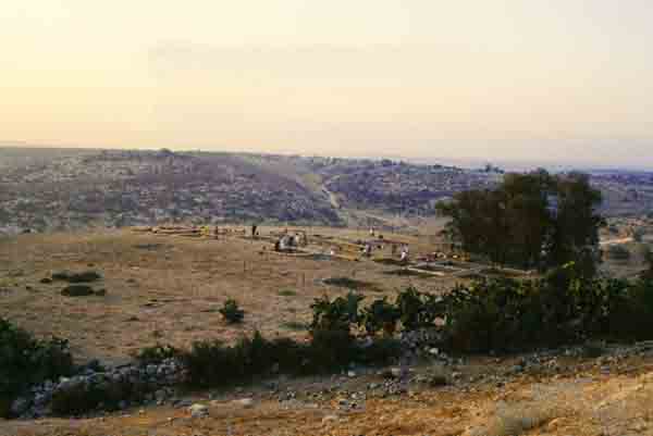
After a preliminary two-week season in 1997 graphically confirmed the size of the site, its continuous occupation and, most importantly, the accessibility of the early remains, the first full, four-week season of excavation was mounted in 1998. We have now completed four full seasons of excavation at Tell es-Safi.15 The wealth of information we have recovered makes it probable that the excavation will continue as long as funding lasts or until the dig directors retire, whichever comes first!16
While most scholars accept our identification, some still disagree.17 Perhaps the most prominent dissenter before our excavation was the dean of Biblical archaeologists, the late William Foxwell Albright, who died in 1971. Albright, a Bible scholar as well as an archaeologist, focused, for example, on a phrase in the story of David and Goliath. After Goliath’s defeat, the text tells us, the Israelites pursued the Philistines “all the way to Gath and to Ekron” (1 Samuel 17-52) or as it might also be translated, “until Gath and Ekron.” Albright contended that this phrase was meant to express the entire extent of Philistine territory, not that the two sites were close together. He compared this phrase to the Biblical expression “from Dan to Beersheba,” which describes all of ancient Israel’s territory from north to south. Just as Dan is in the far north of Israel and Beersheba in the far south, Ekron, Albright argued, was in northern Philistia and Gath in southern Philistia.
Albright’s candidate for Gath was Tel Erani, in southeastern rather than northeastern Philistia. But excavation of this site has failed to uncover a significant amount of Philistine bichrome ware—the red and black pottery that is the hallmark of Philistine material culture. Tel Erani cannot be Philistine Gath.18
Albright’s student G. Ernest Wright advocated a site even farther south, Tel Sera’ (Tell esh-Sheri‘a), but this too must now be ruled out due to inappropriate finds and its improbable location.19
Lawrence Stager, the excavator of Ashkelon who initially questioned our identification of Gath, has recently indicated in personal communications that he too now leans toward the identification of Tell es-Safi with Philistine Gath.
One of the geographical arguments we use in our favor is sometimes turned on its head as an argument against the identification of Tell es-Safi as Gath- Gath is only 6 miles from Ekron, far too close. In fact, however, the settlement histories of these two cities in the Iron Age (1000–586 B.C.E.) are for the most part mirror images of each other, especially in their later Philistine phases.
But let’s look at the early phases of Philistine pottery first.
Massive amounts of early Philistine monochrome pottery (decorated in only one color and known technically as Mycenaean IIIC-1b pottery) found at Tel Miqne underscore the importance of Ekron during Iron Age I (1200 B.C.E.–1000 B.C.E.). Thus far we have found only small amounts of this early form of Philistine pottery at Tell es-Safi, but this may be because we have not yet reached in many places the levels associated with the initial Philistine settlement of the site. This paucity may just be a reflection of the luck of the archaeological draw. Or perhaps Tell es-Safi did not have a strong Philistine presence during the earliest stage of Philistine settlement in Canaan. The large amounts of Philistine bichrome ware, the potterty decorated with red and black and which came after monochrome pottery, at both Ekron and at Tell es-Safi indicate that both cities were major players during the period of Philistine expansion in Iron Age I. Their location in the fertile “Philistine Alluvial Basin”20 probably afforded them ample resources for joint expansion.
At the beginning of Iron Age II (1000 B.C.E.), Ekron went into a steep decline, from which it recovered only in the eighth century B.C.E. after the 721 B.C.E. Assyrian conquest snuffed the northern kingdom of Israel out of existence.
On the other hand, Tell es-Safi, according to our pottery and architectural finds, flourished in the tenth and ninth centuries B.C.E. It was destroyed in the late ninth or early eighth century B.C.E., after which its population was vastly reduced.
This archaeologically-based reconstruction of the history of the site is in accord with what the Bible (and extra-Biblical sources) tell us about Gath.
By David’s time (tenth century B.C.E.), the Philistines were relegated to a minor political role on the world stage, but their economic influence seems to have been greater than their political power. They maintained their independence, although their material culture had become assimilated into the larger Semitic culture that surrounded them. For close to four centuries, the Philistines, caught between several rivals (Israel and Judah to the north and east, Egypt to the south and, successively, the Arameans, Assyrians and Babylonians farther to the north) held together—until Nebuchadnezzar’s conquest of 604 B.C.E. Yet more than a hundred years before the end of Philistine national identity, Gath apparently was destroyed. According to 1 Chronicles 18-1, David “subdued” Gath and took the city and its dependencies from the Philistines. The parallel passage in 2 Samuel 8-1, does not make this claim, however, so it is of questionable reliability. In any event, Gath was apparently independent in the middle of the eighth century B.C.E., since we are told that King Uzziah/Azariah of Judah breached the walls of Gath, Yavneh and Ashdod (2 Chronicles 26-6). No similar claim is made in 2 Samuel, so again the passage is of questionable reliability. Nonetheless, it is significant that Gath is once again mentioned in connection with Ashdod in northern Philistia.
After that, Gath more or less disappears from the Biblical narrative. In the prophetic oracles against the nations, where we might expect Gath to be mentioned, it is noticeable by its absence. In the works of the literary prophets active in mid-eighth century B.C.E., the old Philistine Pentapolis has become in effect a Tetrapolis, a confederation of four, rather than five, cities (Jeremiah 25-20; Amos 1-6–8; Zephaniah 2-4; Zechariah 9-5–7). Gath makes only cameo appearances in Micah and Amos. (In Micah, Gath appears in a poetic allusion to David’s lament over Saul and Jonathan [Micah 1-10; see 2 Samuel 1-17–27]. In Amos, Gath appears in conjunction with the cities of Calneh and Hammath, whose fates, or coming fates, are to serve as a warning to Amos’s audience [Amos 6-2].21)
In an inscription describing his campaign against Philistia, the Assyrian monarch Sargon II lists Ashdod, Gath and Ashdod-Yam (Asdudimmu) among his conquests in 712/711 B.C.E.22 After that, Gath disappears from the historical record.
We have found a stratum at Tell es-Safi clearly indicating destruction from sometime in the late ninth century to early eighth century B.C.E. As early as our first season, we hit Iron Age remains within 5 to 16 inches of the surface. In most squares we descended directly to a rich destruction level about 3 feet thick that we have tentatively dated to the late ninth or early eighth century B.C.E.23 In that destruction level, we found several buildings with everything from the roofs to the floors and whatever had been in between. Hundreds of intact or completely restorable pottery vessels have been recovered, including numerous types of cooking, storage and cultic vessels, of both local and non-local origin. We also found enough so-called Ashdod Ware to consider changing its name to “Gittite Ware.” This dark-red-slipped and black-and-white-striped style of pottery is the possible successor of Philistine bichrome ware and may represent a fusion of both Philistine and Phoenician decorative styles.
We also found many examples of a type of storage jar that is similar to, but predates, the so-called lmlk-jars (belonging to the king) of the late eighth century B.C.E.
The fire that destroyed the site was so intense that some mudbrick walls were baked solid, while others simply melted. In the collapse from a roof or a second story, we discovered two collections of loom weights, still in their frame, from which we were able to collect a few pieces of burnt wood.
We also discovered several incised cow scapula (shoulder blades). Such objects have been found at several Philistine sites and seem to have had cultic purposes; they have Aegean or Cypriote origins.24 Until now they have come from Iron Age I (1200–1000 B.C.E.) levels. Their discovery in the ninth/eighth century B.C.E. level at Tell es-Safi shows the continuity of the Philistine religious traditions into the later Iron Age.
One of our most exciting and unusual discoveries came as a result of aerial photography. Encircling three sides of the tell (all except the north) for a distance of about 1.5 miles is a trench not readily visible from ground level (unless you know what you are looking for). Geologists and geomorphologists assured us that the trench is not a natural feature. Since it crosses hill and dale, we know it could not be a water moat; water does not flow uphill. At first we tried cutting sections through the trench with backhoes, but we found nothing significant. During the 2000 season, however, we hired a team of laborers to cut a section through it manually; they excavated more than 13 feet down without reaching the bottom of the trench. During the 2001 season they finally reached bottom, almost 20 feet below the surface! At the bottom, the trench is squared off and smooth. The top of the trench is about 25 feet wide, narrowing to a still-impressive 13 feet at the bottom. The lowest levels of the trench contained Iron Age pottery. The upper 6 feet included Roman and Byzantine vessels. A number of sling stones for military use were found nearby.
We know of no archaeological parallels to this trench. A recent book notes that although siege moats are described in two ancient texts (Thutmosis III’s siege of Megiddo in 1482 B.C.E. and the Zakkur inscription, which describes the siege in about 800 B.C.E. of the northern Syrian city of Hadrach by Bir-Hadad, son of Hazael), no such moats had yet been found in archaeological excavations.25 That is no longer true. Our mysterious trench is just such a dry siege moat, dug by the besiegers of the city, who had both massive manpower and the time to invest in a lengthy siege. The moat was not to keep the city’s attackers out, but to keep residents from escaping, to prevent them from receiving supplies and to prevent them from attacking the besieging forces.
Whoever dug the trench had to break through a layer of hard limestone before reaching the softer layers underneath. Rather than dumping the dug-out material down the slope of the hill, the builders worked against gravity, heaping the debris on the slope above the trench. This protected the besiegers from counterattacks by the defenders and allowed hidden movement of supplies, troops and perhaps even chariots.
The only open side was the northern border of the tell. There was no need to extend the trench north of the city because the Elah Valley, which was 13 feet lower in antiquity than it is today, would have formed a natural barrier to prevent escape.
The lowest level of pottery in the trench was presumably left by the attackers. A preliminary analysis indicates the pottery dates to Iron Age II and is similar to types from northern Israel or southern Syria. This may hint that the attackers were possibly Arameans, the troops of the Aramean King Hazael during his campaign against Philistia as mentioned in 2 Kings 12-18. This possibility is strengthened by the fact that the Zakkur inscription records that the same siege tactic—the use of a dry moat—was used by Hazael’s son Bir-Hadad just a few years later. We may have here an Aramean method of siege. The mention of the destruction of Gath in Amos 6-2 may thus be an allusion to the mighty siege and fiery destruction of the city at the hands of Hazael in the late ninth century B.C.E.
Have we found definitive proof that Tell es-Safi is Philistine Gath? No, but we have shown a high likelihood. Maybe next summer we will find an inscription reading “Welcome to Gath, Home of Goliath’s Gorillas, Basketball Champions of Philistia.” One never knows what the next spade will turn up.
a. See Volkmar Fritz, “Where is David’s Ziklag?” BAR 19-03.
b. See Lawrence E. Stager, “When Canaanites and Philistines Ruled Ashkelon,” BAR 17-02.
1. See Carl S. Ehrlich, “Goliath,” Anchor Bible Dictionary (New York- Doubleday, 1992), vol. 2, pp. 1073–1074.
2. See, most recently, the essays by David O’Connor (“The Sea Peoples and the Egyptian Sources”), Trude Dothan, (“Reflections on the Initial Phase of Philistine Settlement”) and Israel Finkelstein (“The Philistine Settlements- When, Where and How Many?”) in The Sea Peoples and Their World- A Reassessment, ed. Eliezer D. Oren (University Museum Monographs 108; University Museum Symposium Series 11; Philadelphia- University Museum, 2000), pp. 85–101, 145–158 and 159–180.
3. Moshe Dothan, “Ashdod,” The New Encyclopedia of Archaeological Excavations in the Holy Land (NEAEHL) (Jerusalem- Israel Exploration Society and Carta, 1993), vol. 1, pp. 93–102.
4. Asher Ovadiah, “Gaza,” NEAEHL, vol. 2, pp. 464–467.
5. See Joseph Naveh, “Khirbet al-Muqanna‘—Ekron- An Archaeological Survey,” Israel Exploration Journal (IEJ), vol. 8 (1958), pp. 87–100, 165–70.
6. Seymour Gitin, Trude Dothan and Joseph Naveh, “A Royal Dedicatory Inscription from Ekron,” IEJ 47 (1997), pp. 1–16. See also Aaron Demsky, “Discovering a Goddess,” BAR 24-05, and Gitin and Dothan, “Ekron of the Philistines—Part I,” BAR 16-01 and “Ekron of the Philistines—Part II,” BAR 16-02.
7. Anson Rainey, “The Identification of Philistine Gath,” Eretz Israel 12 (1975), pp. 63*–67* (Hebrew Section) and William M. Schniedewind, “The Geopolitical History of Philistine Gath,” Bulletin of the American Schools of Oriental Research (BASOR) 309 (1998), pp. 69–79.
8. See James L. Porter, “Gath,” in William Smith, ed., A Dictionary of the Bible (London- John Muray and Walton & Maberly, 1863), pp. 655–656, following observations made on a trip through Philistia in 1857.
9. See Frederick Jones Bliss and R. A. Stewart Macalister, Excavations in Palestine during the Years 1898–1900 (London- Palestine Exploration Fund, 1902), pp. 28–43, 63–66.
10. Schniedewind, “Geopolitical History,” p. 70.
11. See David A. Dorsey, The Roads and Highways of Ancient Israel (Baltimore- Johns Hopkins Univ. Press, 1991), pp. 189–191.
12. Yohanan Aharoni and Ruth Amiran, “A Survey of the Shephelah Tells,” Yediot, vol. 19 (1955), pp. 222–225 (Hebrew); M. Israel, “Survey and Study of the Kfar Menahem Region,” Teva va-Aretz 5/5 (1963), pp. 2–4 (Hebrew).
13. T. Ornan, A Man and His Country- The Dayan Collection Catalogue (Jerusalem- Israel Museum, 1986).
14. See Adrian J. Boas and Aren M. Maeir, “The Renewed Excavations at Tell es-Safi/Gath,” in Oren Ackermann, ed., The Judean Shephelah—Man, Nature and Landscape- Proceedings of the Eighteenth Annual Conference of the Martin (Szusz) Department of Land of Israel Studies, May 19th 1998 (Hebrew; Ramat Gan- La-student, 1998), pp. 33–39; and Boas, Maeir and Tami Schneider, “Tel Zafit,” Excavations and Surveys in Israel, vol. 20 (1998), pp. 114*–115* (Hebrew Section).
15. Maeir directs the excavation, assisted since 1999 by Carl S. Ehrlich of York University in Toronto.
16. On the current excavations, see also Maeir, “The Philistine Culture in Transformation- A Current Perspective Based on the Results of the First Seasons of Excavations at Tell es-Safi/Gath,” Maeir and Eyal Baruch, eds. Settlement, Civilization and Culture- Proceedings of the Conference in Memory of David Alon (Hebrew; Ramat Gan- Bar-Ilan University, 2001), pp. 111–129; “Tel Zafit—1998,” Hadashot Arkheologiot (HA, vol. 112 (2000); Maeir and Boas, “Archaeology in Israel- Tell es-Safi,” American Journal of Archaeology, vol. 102 (1998), pp. 785–786; “Tel Zafi—1997,” HA, vol. 110 (1999), p. 68; Maeir, and Carl S. Ehrlich, “Tel Zafit—1999,” HA, vol. 112 (2000); Avraham Negev and Shimon Gibson, eds., Archaeological Encyclopedia of the Holy Land (New York-London- Continuum, 2001), p. 445.
17. For a review of the literature, see William F. Stinespring, “Gath,” Interpreters Dictionary of the Bible, vol. 2, pp. 355–356; Joe D. Seger, “Gath,” Anchor Bible Dictionary, vol. 2, pp. 908–909; Schniedewind, “Geopolitical History,” pp. 69–79, esp. 69; Ephraim Stern, “Zafit, Tel,” NEAEHL, vol. 4, pp. 1522–1524.
18. See Shmuel Yeivin and Aharon Kempinski, “Erani, Tel,” NEAEHL, vol. 2, pp. 417–422. When Tel Erani was still a viable candidate, it was renamed Tel Gat, and the modern Israeli town nearby Qiryat Gat (the “Town of Gath”).
19. See Eliezer Oren, “Sera, Tel,” NEAEHL, vol. 4, pp. 1329–1335 and Schniedewind, “Geopolitical History,” p. 74.
20. Schniedewind, “Geopolitical History,” pp. 70, 76 note 1.
21. See Ehrlich, Philistines, pp. 160–161.
22. James B. Pritchard, ed., Ancient Near Eastern Texts Relating to the Old Testament (Third edition with supplement; Princeton, NJ- Princeton Univ., 1969), p. 287.
23. The ceramic typology appears to be earlier than Lachish III or Miqne II, but later than “classic” late Iron Age I–early Iron Age II (Miqne IV or Ashdod XI–X). Parallels may be identified in Kuntillet ‘Ajrud, Lachish IV–V or Ashdod IX–VIII. Preliminary radiocarbon dating would place the assemblage more in the early eighth than the late ninth century.
24. Amihai Mazar, “The Temples and Cult of the Philistines,” in Oren, The Sea Peoples, p. 227.
25. Dag Oredsson, Moats in Ancient Palestine (CB OTS 48; Stockholm- Amlqvist & Wiksell International, 2000), p. 178. A cuneiform tablet from Mari also refers to a siege moat. See G. Dossin, Correspondence de Sðamsûi-Addu et ses fils (Archive royale de Mari I; Paris, 1950), vol. 90, pp. 18–21; and the brief discussion in Israel Eph‘al, Siege and Its Ancient Near Eastern Manifestations (Hebrew; Jerusalem- Magnes, 1996), p. 41.