
Turin Papyrus, c. 1150 BCE
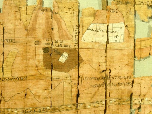
The Turin Papyrus is an ancient Egyptian map, generally considered the oldest surviving map of topographical interest from the ancient world. It is drawn on a papyrus reportedly discovered at Deir el-Medina in Thebes, collected by Bernardino Drovetti (known as Napoleon’s Proconsul in Egypt) sometime before 1824 and is now preserved in Turin’s Museo Egizio.
The map was drawn about 1160 BCE by the well-known Scribe-of-the-Tomb Amennakhte, son of Ipuy. It was prepared for Ramesses IV’s quarrying expedition to the Wadi Hammamat in the Eastern Desert, which exposes Precambrian rocks of the Arabian-Nubian Shield. The purpose of the expedition was to obtain blocks of bekhen-stone (metagraywacke sandstone) to be used for statues of the king.
The map shows a 15 kilometer stretch of Wadi Hammamat including geographical information such as rock and gravel types.
See also-
Subscribe
If you enjoyed this article, subscribe to receive more just like it.


