Cabul: A Royal Gift Found, Zvi Gal, BAR 19:02, Mar-Apr 1993.
 Hiram of Tyre scorned King Solomon’s offering of 20 cities—called Cabul
The key to the identification is geography and, as so often happens, an Arabic place name that preserved, with slight modification, the Biblical name.
Cabul is also referred to in the tribal allotments described in Joshua 13–21. It is mentioned in Joshua 19-27 as a town allotted to the tribe of Asher, on its border. In the Lower Galilee there is an Arab village called Kabul, which obviously preserves the Biblical name. Kabul easily fits the location of the Cabul mentioned in the Bible. But no Iron Age (1200–586 B.C.) site in the vicinity had been identified by archaeologists—until our survey.
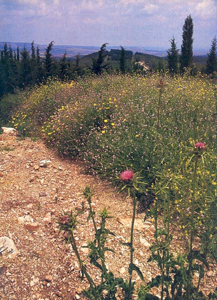
In the course of our archaeological survey of the Lower Galilee,1 we located a series of sites that correspond to the Biblical description of the boundary between Asher and Zebulun.2 One of these sites, Hurvat Rosh Zayit (Khirbet Ras el Zeitun in Arabic, “the ruin of the head of the olive,” stands on a narrow ridge less than a mile from the village of Kabul. This ridge is one of many that form the hilly area lying east of the coastal plain and extending as far north as Beirut. Our first hint that Hurvat Rosh Zayit might be Biblical Cabul came on our first visit to the site, when we stood on the summit of the ridge and saw how close we were to the Arab village of Kabul.
Our survey of the site found local limestone blocks in a small mound, 80 by 80 feet and rising 10 feet from its bedrock foundation. Around it stood a number of small stone piles averaging 15 feet in diameter and many loose, dressed stones. We also discovered surface potsherds dating to the tenth to ninth centuries B.C. (Solomon reigned from about 961 to 921 B.C.)
So the location was right, the date of occupation was right and the Biblical name was preserved in a nearby Arab village. This is enough, even to a cautious archaeologist, to suggest that we have located Biblical Cabul.
The surface remains were intriguing enough to justify a dig, which we launched in 1983.3 What we have found in six seasons of excavation is an impressive fort, apparently built by King Hiram to serve as an administrative center for the region—perhaps the region given to him by King Solomon.
Four areas have been excavated so far. The main area, on a small tell, contains a square fortress dating to the tenth to ninth centuries B.C. built on an earlier phase which was probably one of Asher’s settlements. Sixty-five feet to the east, we found a two-room pillared building. In two areas to the west of the fortress, excavation revealed a large complex of oil presses and an Israelite four-room house.
The fortress consists of a single building surrounded by a massive wall. This wall had two phases of construction. The later wall, preserved up to 10 feet in height, was built in the ninth century B.C. upon the ruins of the earlier, tenth-century B.C. wall. The northern, eastern and southern sides of this later wall are attached to the sides of the building. Only on the western side did the builders leave a 6.5-foot-wide corridor where the main doorway was between the wall and the side of the building. Towers rose from the fort’s four corners. Of these, we have excavated the northwest and southwest towers.
Like the outer wall, the building exhibits two phases of construction, tenth and ninth centuries B.C., with the later structure reusing the main walls of the earlier one. Fragments of the walls of the earlier phase were found in the northwest and southwest towers, as well as in the rooms on the eastern side.
The entrance to the building was in the northwest corner. Inside, a 16- by 10-foot central hall had two rooms on both its north and south sides and three rooms on its east side. Each room has a doorway made of well-cut blocks laid using the header-and-stretcher technique.a This masonry technique can also be observed at the outer corners of the building, where nine courses of dressed stones were found.
The ground plan of the fortress, which served both the earlier and later phases, resembles Assyrian-type structures, especially from the eighth and seventh centuries B.C. The main characteristic of the Assyrian buildings was their central courtyard or hall. The resemblance of our fortress to this type of building may point to a Syro-Phoenician origin. This ground plan is not known from any other site in Israel.
The later fortress has been entirely exposed, and it is clear that it consisted of two levels. The elevation of the upper floor is marked by stone thresholds, and the basement was founded on bedrock. The floor of the upper level was made of wooden beams, which collapsed into the basement below when the fortress was destroyed. We know this because we have excavated about 10 feet of accumulated debris from the upper level, including remains of the wooden beams. Objects from the upper level were found in total disorder, but nevertheless preserved.
Below this debris, the vessels on the basement floor, consisting mostly of storage jars, stood in well-organized rows. Three basement storage rooms have been dug so far. Each contained dozens of these jars. Such jars are the most common vessels in the fortress; altogether, 300 of them have been found in the fort’s two phases. The average volume of a single jar is about 6.5 gallons, so the total capacity of the jars found so far is about 2,000 gallons. This large storage capacity suggests that the fortress served as an administrative center and storage facility.
Other finds also point to this conclusion- a small group of clay seals, used to secure goods against tampering during official transportation; a clay stopper with a seal impression; and a fragment of a jar shoulder bearing finely inscribed Phoenician letters- [yy]n hmr (wine of Hemar), possibly referring to a variety of wine.
A unique group of vessels was found in the north-western tower. It consists of a bichrome jar, three large Cypro-Phoenician bowls, and a kernos. All of these objects point to a probable cult room. Of these, the kernos is the most interesting vessel. It is made of a rounded tube to which four hollow objects are attached- a cup, two pomegranates and a bull’s head. The cup was covered with soot, which indicates that some incense was burnt in it, although its precise use is unknown. The kernos is a cult object usually associated with Philistine sites dating from the 12th to 11th centuries B.C. Our kernos dates from the first half of the 10th century B.C. It is not surprising that this late specimen was found in a coastal site.
Who built this fortress? The most important evidence is the rich assemblage of Phoenician and Cypriot vessels we found. This includes, in addition to the storage jars, many large bowls, jugs and very small juglets of Black-on-Red ware. These are made of a fine clay, slippedb in orange, well burnished and decorated with horizontal black bands and, on some, with concentric circles on their shoulders. Another group of vessels is the bichrome ware, which includes jars and jugs decorated with black and red bands and a palm tree motif. Also found were red slip bowls and juglets (known as Samaria Ware or Akhziv Ware), two Cypriot-white painted vessels, a large amphora and a large barrel jug. This is one of the largest assemblages of Cypro-Phoenician ware ever discovered in Israel. In addition, we should emphasize that the header-and-stretcher masonry employed in the fortress is a well-known Phoenician style. It is clear that typical Iron Age Phoenician attributes characterize the Hurvat Rosh Zayit fortress.
Analysis of all the pottery found so far indicates a tenth- to ninth-century B.C. date for the fortress. The earlier fortress was built about the middle of the tenth century B.C. and was destroyed shortly afterward (why and by whom we don’t know). The later fortress was completely destroyed in the middle of the ninth century B.C., so it lasted for no more than a century. The final destruction was caused by an enemy who attacked the fortress and set it on fire, as shown by the many iron arrowheads found at the main entrance and by the burnt walls. In the light of this evidence, we can place both the establishment of the fortress and its final destruction within a secure historical framework.
As already noted, the site can be identified with Biblical Cabul on the basis of the name’s preservation at nearby Kabul, the dating of the site and the evidence of Phoenician occupation. In order to maintain his sovereignty over the lands given him by Solomon, Hiram, the Phoenician king, built this administrative center, which was probably controlled by a high official in Hiram’s court. The adjacent lands were cultivated, and wine, olive oil and cereals were collected and stored in the fortress.
The final destruction of Hurvat Rosh Tayit probably came in 841 B.C., at the hands of the Assyrian king Shalmaneser III, who conducted a military campaign in which he besieged Damascus and then invaded the Lower Galilee. Destruction resulting from this campaign was traced by us in more than 50 percent of the Iron Age sites surveyed.4 Shalmaneser finally erected his royal stela at Mt. Ba’al Rasi5, identified by scholars as Mt. Carmel or Rosh ha-Niqrah, both of which are near Hurvat Rosh Zayit.
The fortress was then completely abandoned, but after a short period of time the site was reoccupied. The new settlers ignored the ruined fortress and established a village with buildings scattered over the summit. We excavated two buildings of this village, which present typical architecture associated with the Israelites- a four-room house and a two-room house with a row of stone pillars, similar to those at Hazor. The Israelite nature of the village is also evident in the cooking pots found in these buildings, which are identical to those from eighth-century B.C. Israelite sites like Hazor, but absent in contemporary Phoenician sites.6
These settlers based their economy largely on the production of olive oil. A large complex of oil presses is now being excavated on the west side of the site. Within a well-built structure, we have found at least three presses, and another press outside the structure has been excavated and reconstructed. These presses, together with the many rockcut installations found oil the surface around this area, make this the largest known oil-press complex in Biblical Galilee.
Like the entire Galilee, this village was destroyed, and its inhabitants probably deported, by the Assyrian king Tiglath-pileser III, who conquered the northern kingdom of Israel in 733/732 B.C. Since then the site has been forgotten and ignored.
On completion of the present project, the site will be restored and opened to the public.
a. In this technique, used to give added strength to a wall, the long and short sides of the rectangular blocks are alternately laid parallel to the length of the wall.
b. Slipping is a special treatment in which the potter covers the vessel’s body with red or orange color and thus creates a fine ware with a shiny surface.
1. The survey was carried out in 1974–1983, on behalf of the Archaeological Survey of Israel, with the participation of G. Landaw, Y. Yotvar, A. Tavori, the late V. Kulmann and students of the Department of the Land of Israel Studies, University of Haifa. See Zvi Gal, Lower Galilee During the Iron Age, ASOR Dissertation Series 8 (Winona Lake, IN- Eisenbrauns, 1992).
2. Gal, “Cabul, Jiphtahel and the Boundary between Asher and Zebulun in the Light of Archaeological Evidence,” Zeitschrift des deutschen Palastina Vereins.
3. The excavations are carried out on behalf of the Israel Antiquities Authority and the Institute of Archaeology, University of Haifa and with collaboration of the Nelson Glueck School of Biblical Archaeology, Hebrew Union College, Jerusalem. 101 (1985), pp. 114–127.
4. Gal, “The Lower Galilee in Iron Age II, Analyzing Survey Material and Its Historical Interpretation,” Tel Aviv 15–16 (1988–1989), pp. 56–64.
5. James B. Pritchard, ed., Ancient Near Eastern Texts Relating to The Old Testament, 3rd ed. (Princeton, N.J.- Princeton Univ. Press, 1969), p. 280.
6. Yigael Yadin et al., Hazor I (1959). Jerusalem Pl. LXXV; Hazor III–IV (1960). Jerusalem Pl. CCV.
Subscribe
If you enjoyed this article, subscribe to receive more just like it.


