First Map of the Holy Land, 1475
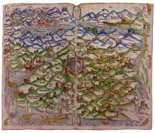
First Map of the Holy Land
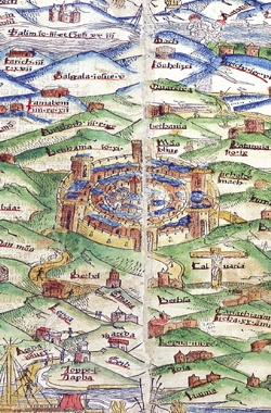
The First Map of The Holy Land and The First Modern Printed Map
Holy Land, Brandis, Lucas. Map Of Palestine. Lübeck- Brandis, 1475, from Rudimentum Novitiorum sive Chronicarum Historiarum Epitome, 1475.
In 1475 (some 25 years after the invention of printing from moveable type) Lucas Brandis published an encyclopaedic work about Christianity to which he added two maps which thus became the first printed maps, all previous maps having been manuscripts. One is a circular world map centered on the Holy Land. The other, shown here, is a map of the Land of Israel with Jerusalem at its center. In common with most mediaeval maps it, too, describes the Bible lands not geographically but symbolically.
19th Century Shop catalogue
Jewish Virtual Library- The First Printed Maps, by Lucas Brandis
Subscribe
If you enjoyed this article, subscribe to receive more just like it.


Er interessant. Wat is de eerste gedrukte kaart van Palestina en van Jerusalem?
Met vriendelijke groeten, Maarten Klein For Maps in Bibles.